- Agriculture /
- Floods submerge crops on 32,992 hectares in Rangpur region

FT Online
Published:2019-07-23 00:21:01 BdST
Floods submerge crops on 32,992 hectares in Rangpur region
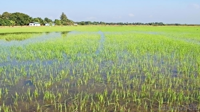
Standing crops on 32,992 hectares of land were inundated by floodwater in all five districts in Rangpur division.
Officials of the Department of Agricultural Extension (DAE) said there are less chance of submergence of more standing crops as the flood situation is improving fast with sharp recession of floodwater.
The submerged crops included standing Aush rice on 8,998 hectares of land,
Aman rice on 47 hectares, Aman rice seedbed on 5,999 hectares, jute on 14,192
hectares, vegetables on 3,116 hectares, spices on 547 hectares, Banana on 170
hectares, sugarcane on 70 hectares and betel leaf on three hectares of land.
Of them, standing crops on 105 hectares of land have been submerged in
Rangpur, on 12,803 hectares in Gaibandha, on 19,638 hectares in Kurigram, on
325 hectares in Nilphamari and on 121 hectares of land in Nilphamari
districts.
The submerged crops on 32,992 hectares of land made up over 21.37 percent
of total standing crops on 1,54,353 hectares of land in these five districts
of the agriculture region.
Officials of DAE and other organizations are suggesting the affected
farmers for taking necessary steps to overcome the situation after recession
of floodwater from their submerged crop lands.
Additional Director of DAE for Rangpur region Muhammad Ali said farmers are
being suggested to prepare late variety seedling of Aman rice and early
variety vegetables for cultivation on their submerged croplands after
recession of floodwater.
The government would assist flood-hit farmers in recouping crop losses
through re-transplantation of late variety Aman rice seedling and cultivating
other substitute crops after recession of floodwater.
Superintending Engineer of BWDB for Rangpur Circle-1 Harun Ar Rashid said
water levels of all major rivers marked sharp falls at all points, except at
Dalia (where rose by 5cm), improving flood situation in last 24 hours till 6
am today.
Water levels of the Dharla marked fall by 36cm at Kurigram, Ghaghot by 16cm
at Gaibandha, Brahmaputra by 32cm at Noonkhawa and 26cm at Chilmari, Jamuna
by 28cm at Fulchhari, 27cm at Bahadurabad, 30cm at Sariakandi, 26cm at
Kazipur and 18cm at Sirajganj points during the period.
The Dharla was still flowing above its danger mark by 21cm at Kurigram,
Ghaghot by 53cm at Gaibandha, Brahmaputra by 21cm at Noonkhawa and 61cm at
Chilmari, Jamuna by 101cm at Fulchhari, 110cm at Bahadurabad, 86cm at
Sariakandi, 85cm at Kazipur and 75cm above the danger mark at Sirajganj
points at 6am today.
Officials in the district administration said distribution of relief goods
has further been intensified among flood-affected people in Rangpur region.
Unauthorized use or reproduction of The Finance Today content for commercial purposes is strictly prohibited.